List from bottom of map: Friends Meeting House Seating for 430 with Grave Yard. Corn Mill powered by steam, with well in the grounds. Gas Works, the gasometer storage tanks are not immediately adjacent. Solway Foundry, Iron & Brass. Valentia Foundry, Iron & Brass. Gasometer. Unknown yard. Unknown building. A well and possible pond by the Tannery with its pits to soak the hides, and presumably empty the effluent into the sea.
Pudding Pie Hill is shown with a standing stone – what happened to this feature? When were the industrial buildings demolished?
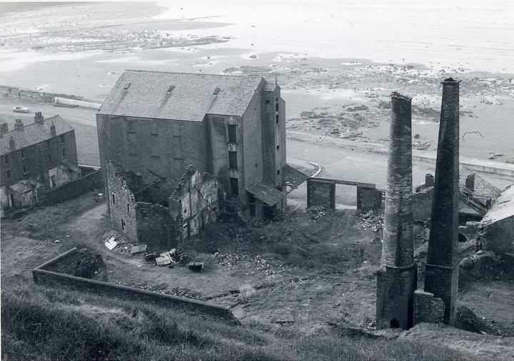
Maryport factories on the shore gas works tannery flour mill NLS 2 NLS https://maps.nls.uk/view/101091529
Map shows the industries on the shoreline ie Gas Works, Old Quarry, Four Mill, Tannery. And Pudding Pie Hill , with Parade Ground marked to the south of the building that becomes the Battery, then the Senhouse Roman Museum Coastguard Station, Friends Meeting House, Watch House on the Groyne by the sea – see picture of the white painted building on the Groyne. Papermill Green is shown under Mote Hill – Castle Hill. Curzon Street does not continue past Station Street ie it does not cross the Ellen in this map revised 1898 published 1901. Phoenix Foundry is shown at Elizabeth Dock.